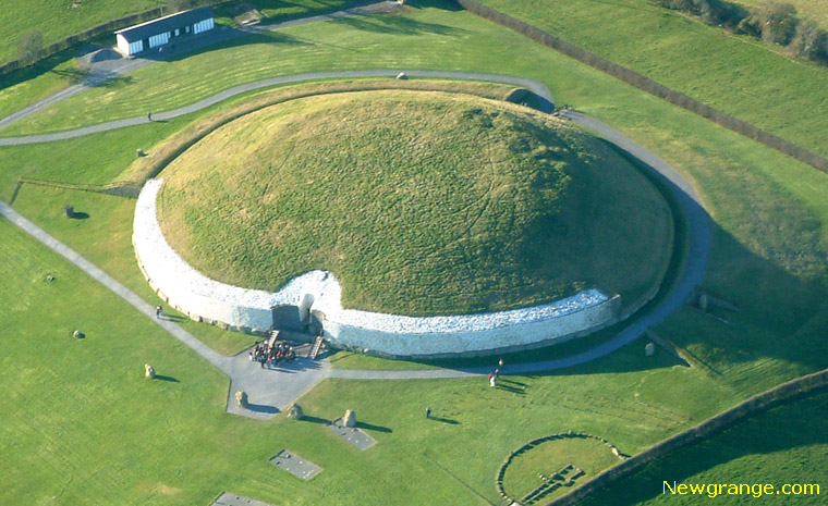
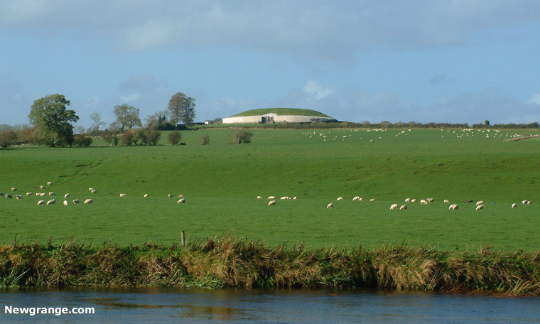
No second chamber found at Newgrange
Dr Conor Brady, archaeologist and lecturer at Dundalk Institute of Technology, said that while there would be no "dramatic announcements" about discovery of a second chamber at Newgrange at this stage, the microgravitational technology used in the experiments had proven valuable to archaeologists and scientists.The weather conditions encountered by the team at Newgrange created difficulty in the use of the highly sensitive equipment, it had nevertheless shown that "it works". The purpose of the microgravitational equipment was to detect underground cavities. The microgravity meter responds to variations in density in the ground beneath it.
There may still be another passage there - this was not a full survey of the entire mound. We were able to demonstrate that the technology works and that there is a value in considering a more comprehensive survey of Newgrange and other mounds. When that might happen is anyone's guess given the state of the economy.
Source: The Meath Chronicle - November 9th 2011 and direct contact with Dr. Conor Brady.
New Archaeological Survey Techniques at Newgrange
There was a high-tech archaeological survey conducted at Newgrange National Monument in the Brú na Bóinne World Heritage Site in Co. Meath over the week of Monday 17th October. The key objective of the survey was to investigate whether there ware any hidden passageways and chambers in Newgrange Passage Tomb and the survey team were using some techniques not used before on archaeological sites in Ireland.Microgravity
The Microgravity method is based on state-of-the-art precise recording of anomalies in the Earth's gravity field with the objective of detecting the responses of small-scale, sub-surface density inhomogeneities. Microgravity is a specialised method in archaeogeophysical prospection where it has been successful in the detection and description of shallow-lying cavities such, as crypts, chambers, tombs, cellars etc.3D view of the Newgrange Passage Tomb together with the modelled passageway/chamber structure and its simulated gravitational anomaly when measurements are made on the top surface of the tomb.
Magnetic Gradiometry
This technique is regarded as the prime survey method in many archaeological geophysical surveys. It measures very small variations of the vertical component of the Earth's magnetic field which can be related to archaeological features and objects containing ferrous minerals. These features can be walls and silted ditches. Positive magnetic gradient normally being attributable to ditches and other cut features and negative gradient being related to buried walls. The summit of the tomb has never been surveyed magnetically and it is proposed to magnetically survey it to investigate the possibility of hidden archaeological features such as ditches and pits.Earth Resistance Technique
The earth resistance technique is well established in surveying archaeological sites. It largely responds to variations in soil moisture which can be influenced by sub-surface walls and silted ditches. Higher resistance being attributable to walls and more compacted ground and lower resistance being related to the fill of silted ditches or other cut features. The survey on the summit will map soil moisture patterns which may relate to sub-surface features such as the known passage and chamber and any other features which may relate to anomalous drainage patterns.Electrical Conductivity Technique
This method has had little use on archaeological sites in Ireland. This is largely due to problems with instrumental and temperature drift. A new instrument has recently been introduced and trials have provided relatively drift-free results. Electrical conductivity is the reciprocal of resistance or resistivity. It provides for faster surveys with the additional advantage of mapping at different depth levels in a single survey. The GF Instruments CMD-Mini Explorer with simultaneous 0.5m, 1.0m and 1.8m full depth ranges is designed for the investigation of shallow layered structures. Low electrical conductivity anomalies are due to high sub-surface resistivity variation which can be related to buried walls or more compacted ground. High electrical conductivity anomalies are due to low resistivity variation due to silted ditches or other cut features. It is proposed to survey the summit of the mound on a 1m x 0.25m grid or better depending on initial results.Electrical Resistivity Tomography (ERT) Technique
This method was first carried out on a mound in Ireland in 1994 (Waddell & Barton, 1994). The method provides modelled depth pseudosections of sub-surface variation in electrical resistivity. The variation in resistivity can be interpreted in terms of the sub-surface or internal structure of a mound. It is proposed to carry out ERT surveys across the summit at two electrode spacings.Project Organisation
The work was carried out by a specialist team from Comenius University and the University of Technology from Bratislava, Slovakia in collaboration with Dundalk Institute of Technology (DkIT), Landscape and Geophysical Services (LGS), the National Monuments Service of the Department of Arts Heritage and the Gaeltacht (NMS) and the Office of Public Works (OPW).The work was originally a component of a joint funding application to the Irish National Strategic Archaeological Research (INSTAR) programme administered by the Heritage Council. The project proposed the large-scale application of multiple remote sensing and geophysical surveys in the Brú na Bóinne WHS in order to comprehensively map the low-visibility and subsurface archaeology of the area. The proposal received very favourable reports from the anonymous reviewers but was not funded due to a drastic cut in the INSTAR budget for 2011 which saw only one applicant project being funded.
Comenius University and the University of Technology, partners in the original application, brought their cutting-edge science and technology to investigate one of Ireland's world-class archaeological treasures. They considered this survey as a unique opportunity to further the scientific investigation of the tomb and refine the use of their technique (microgravity survey) for use on worldwide archaeological sites of this type. The technique has already been used very successfully at the pyramids in Egypt to identify the locations of passages and chambers. The University has managed to find some limited funds to carry out part of the original survey programme and this was gratefully welcomed by the project team.
Boyne Valley Private Day Tour
 Immerse yourself in the rich heritage and culture of the Boyne Valley with our full-day private tours.
Visit Newgrange World Heritage site, explore the Hill of Slane, where Saint Patrick famously lit the Paschal fire.
Discover the Hill of Tara, the ancient seat of power for the High Kings of Ireland.
Book Now
Home
| Visitor Centre
| Tours
| Winter Solstice
| Solstice Lottery
| Images
| Local Area
| News
| Knowth
| Dowth
| Articles
| Art
| Books
| Directions
| Accommodation
| Contact


